Do Council Estates Lead to an Increase in Crime? - Part 3

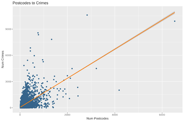
Part 3 - The Ratios We saw in part 2 that there is a relationship between the number of postcodes (which is a proxy for the number of buildings/people) and the number of crimes as well as the number of local authority properties is a given square of the grid. What I want to do in this part is to remove the effect of the number of postcodes and isolate that of the number of council owned properties. To do this I'll use the ratio of both the number of crimes and number of local authority owned properties to the number of postcodes in each square. This gives us a crime ratio and a local authority ratio, which expresses the density of each compared to the general population desity. By this measure, the most criminal place in the UK by this standard is Lindholme near Doncaster, with 16 postcodes but 494 violence and sexual offences, 45 cases of criminal damage and arson and 182 'other' crimes. This happens to be a prison so while accurate, subjectively its not very usefu...

